VOS-Buoy Comparision
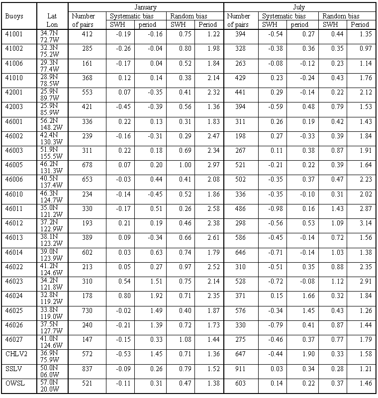
The results presented have to be considered in the context of the uncertainties inherent into visual wave data. We compared our results with in-situ measurements at NDBC and JMA buoys, OWSs, and light vessels in the North Atlantic and North Pacific. Most of NDBC buoys cover a period from the early 1970s onward and report 3-hourly SWH and dominant period. We selected VOS data sampled simultaneously with buoy measurements within 50 km around the buoy location. Wilkerson and Earle [1990] used a radius of 100 km, but they found some differences when varying it from 25 to 100 km. The Table shows the number of buoy-ship pairs selected for January and July, and estimates of systematic and random biases in SWH and dominant period. The systematic bias was estimated as the mean difference between buoy and VOS observations. Then the systematic bias was removed, i.e., both VOS and buoy measurements were adjusted to the same climatological mean, and random uncertainties were estimated as standard deviations of "buoy minus VOS" difference.
Systematic and random "buoys minus ship" biases in SWH (meters)
and dominant period (seconds) estimated for January and July.
Return to "Atlas Maps" page